A tweet posted on the crew’s account said 18 volunteers “mass resigned”
A message posted February 11 on the Twitter account of the Wildland Fire Crew in El Paso County Colorado stated that 18 volunteer firefighters on the crew “mass resigned.” A follow up tweet read, “They said the environment became hostile to the volunteers and they felt they were no longer needed or wanted.” El Paso County is the location of Colorado Springs.
The El Paso County fire crew is part of the County Sheriff’s office which is headed by Sheriff Bill Elder. In Colorado and Wyoming the sheriff is responsible for the suppression of wildfires occurring in the unincorporated areas of the county outside the boundaries of a fire protection district. In Texas this role is assigned to the County Judge.
In a response to the tweets about the resignations, the Sheriff’s office issued a response to what they described as the “unauthorized, inaccurate tweet from the EPC Wildland Fire Twitter Account.” The response, posted below, said, “While there have been some resignations by members of the EPC Wildland Fire Team, the information posted was not accurate.” The statement did not specify what was inaccurate in the tweets about the resignations.
El Paso County has been the location of some devastating wildfires in the last 20 years. In 2012, the Waldo Canyon Fire burned more than 18,000 acres, destroyed 347 homes in Colorado Springs, and killed two people. Almost exactly a year later, the Black Forest Fire ignited east of the city and burned more than 15,000 acres, 486 homes, and killed two people. The Hayman Fire in 2002 blackened 137,760 acres and destroyed 133 homes. In 2018 the MM 117 Fire burned 41,000 acres and 23 homes.
(UPDATE Feb. 17, 2022: KRDO has an article saying the Sheriff’s office told them that 10 members of the fire crew quit.)
In 2014 while on a motorcycle trip that went through Northern California I took a photo of an engine crew from El Paso County that was staging in Chester.
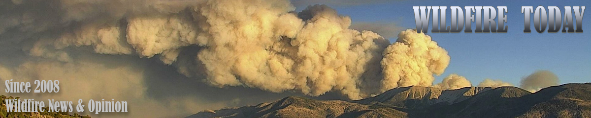
El Paso County Sheriff’s Office engine crew in Chester, California, Aug. 16, 2014. L to R: Collin Wolff, Cameron Hammitt, Peter Ringen, and Captain David Yowell. Photo by Bill Gabbert.
When you have been impacted by a disaster of any kind you are frightened, scared, often very angry and the last thing you need is to fill out forms and answer numerous questions from strangers clamoring to HELP you. So why is it that the majority of our disaster assistance and recovery programs at all levels fail to understand that emotional issues can seldom be resolved by analytical processes?
At a hazards mitigation conference I once attended, one subject kept coming up (albeit often in side conversations): how can we do better with natural hazards preparedness and mitigation? At all levels of government and private industry, the fact that billions of dollars are being spent annually often with very little result is becoming a major concern. That the largest risk companies now estimate that the cost of hazards damage is starting to become incalculable is scaring even the wealthiest countries. The big elephant in the room was the fundamental question of whether it is even possible to understand a subject with massive emotional dynamics through analytical means.
Should this be approached in a very different way? Any victim of a disaster in which their world has imploded in 5 minutes is naturally frightened, upset, and scared. To introduce a program of any kind, no matter how well-intentioned, that does not explicitly recognize this adds additional trauma, leading to complex issues lasting for years.
Two of the presenters at the conference made a huge impact: elders from the Chitimacha Tribe of Louisiana; and Sallie Clark, a Commissioner for El Paso County, Colorado. Their messages were different, but interconnected. In sum, they both stressed the importance of knowing your community and reacting in both a human and efficient systems way, or as Sallie stated so eloquently “Yes, indeed we need to be efficient in our response to a disaster — but let’s not forget that sometimes they just need a hug.”
The Chitimacha (Sitimaxa, “people of the many waters”) are famous because when the FEMA team got to their reservation three weeks after hurricane Katrina, they had already taken care of most of the damage. Communication in the tribe took place mostly by word of mouth, with CB radio assistance. Within 24 hours after the storm had passed, all 1,100 members of the tribe had been contacted by a tribal council team and all needs, both physical and emotional, were being attended to. Rebuilding had started, and in many cases was complete. A major focus of the tribal council was on emotional support, and this ran consistently throughout everything they were doing.
Sallie Clark, a Commissioner for El Paso County, Colorado
Sallie was doing something similar after the 2012 Waldo Canyon fire devastated her Colorado Springs community. That wildfire was one of the most destructive in Colorado history. It took two lives, destroyed 347 homes, forced tens of thousands to evacuate, and insurance claims topped $450M. Sallie’s response: identify everyone impacted, ensure they have a case officer attending their needs both physical and emotional, and simply make sure they have a shoulder to cry on. She personally drove to evacuation shelters and made sure this was being done and gave anyone a hug who needed it. A truly shining example of “WE CARE!”
Coal mine at Marshall, Colorado, 1884 until 1936. 9News
A television station in Denver, 9News, has found that in the general area where investigators are narrowing down the origin and cause of the Marshall Fire northwest of Denver an underground coal seam has been burning since the 1870s.
In December, 2005 after a portion of the burning seam emerged on the surface and started a vegetation fire the Office of Surface Mining advised the City of Boulder, which owns the land, “It would be prudent for the City of Boulder to remove any vegetation from surface cracks, as well as begin a long term maintenance and monitoring program for the area.” In 2005 the spread of the fire was stopped quickly.
The City hauled in 275 tons of gravel with the intention of least insulating the fire from the surface. But these underground fires have a habit of creeping their way back up and too often ignite fires. They are next to impossible to extinguish.
9News reported that the M. P. Fox mine in the area operated from 1884 until 1936.
Pushed by winds gusting at 60 to 100 mph, the Marshall Fire spread rapidly as it destroyed more than 1,000 homes. Most were in the city of Louisville and the town of Superior.
The 9News video below has more details.
On a different topic, but related to the Marshall Fire, we learn in the next video that 17 of the houses that were in the burned area but survived have been sold.
The rapidly spreading blaze destroyed more than 1,000 homes northwest of Denver December 30
Investigators are looking at an old coal mine as the possible cause of the Marshall Fire northwest of Denver, Colorado. Decades ago miners were extracting coal from an area near the location where the Marshall Fire started December 30, 2021. The remaining coal has been burning for years even though dozens of tons of fill were hauled in with the intention of stopping the burning, or at least insulating the fire from the surface. But these underground fires have a habit of creeping their way back to the surface and too often ignite a vegetation fire.
The old mine near the intersection of Highway 93 and Marshall Drive near the town of Marshall is one of 38 active underground coal fires in Colorado. In 2002 a burning underground coal seam ignited vegetation near Glenwood Springs, Colorado which burned 29 homes and more than 12,000 acres.
Wildfire Today had an article in 2008 about an 8-year-old boy who suffered burns on his foot when he walked into an area of Golden Hills park in Colorado Springs, Colorado that was covered in coal dust. Left over from coal mining operations about 80 years earlier, the dust was on fire, smoldering, and it melted the boy’s plastic shoe and gave him second degree burns. If the boy had not “discovered” the fire, it would have spread into nearby vegetation. The cause of the fire was unknown.
Pushed by winds gusting at 60 to 100 mph, the Marshall Fire spread rapidly last month as it destroyed more than 1,000 homes. Most were in the city of Louisville and the town of Superior.
It burned over 6,000 acres and nearly 1,100 homes northwest of Denver, December 30, 2021
Conceptual model of a mountain wave. NWS.
The Denver office of the National Weather Service has released an analysis of the weather that created the conditions on December 30, 2021 that allowed the Marshall Fire southeast of Boulder, Colorado to be turned into a blast furnace that within a few hours ran five miles to the east burning 6,000 acres and destroying nearly 1,100 homes with a total value of more than $500 million.
The NWS described the winds the day of the fire:
High winds developed in the mid morning hours on Thursday, December 30th, 2021, the result of a mountain wave that developed as very strong westerly winds raced over the Front Range Mountains and Foothills and crashed down onto the plains. The mountain wave remained nearly unchanged through the rest of the day, resulting in very persistent and extremely high winds. Mountain waves are usually focused very close to the base of the foothills and adjacent plains. On this day, sustained winds of 50 to 60 mph with gusts of 80 to 100 mph were felt along Highway 93 and points east to around Superior and at times, Louisville.
On the map below, the final fire perimeter is outlined by light purple (upper center of the plot images), while the city of Boulder is located in the northwest corner. The black numbers are temperature (F), red numbers are wind gusts, and the wind barbs point to the direction the wind was from.
Wind gusts (in red), temperatures (in black) at noon, Dec. 30, 2021, Marshall Fire, NWS.
The surface plot for 12 PM MST above shows some of the strongest winds from this wind event. A peak gust of 115 mph was reported at the base of the foothills, just east of the intersection of Highway 93 and Highway 72. Note the 85 mph gust in south Boulder, and a 100 mph gust along Highway 93 (very bottom of the image below) at about noon.
Precipitation in the Denver area, 6 months before Marshall Fire, compared to previous dry periods. NWS.
After a very wet first half of the year that resulted in a lush, tall crop of grass, the six months leading up to the fire in late December were the driest in recorded history, by far. Drought affects moisture in the vegetation — the fuel moisture. The lower is it, the more easily and more intensely it burns in a wildfire. There were many areas in the fire with light vegetation, such as grass, that in December after it has cured would be more affected by recent rain (or the lack thereof) and relative humidity than long term drought. The relative humidity was in the mid-20s that day. But the National Weather Service said larger fuels such as shrubs and trees were plentiful in and around the affected subdivisions. Those fuels would be heavily affected by the historic drought and would have low fuel moistures in the live and dead vegetation.
Drought can also affect the home ignition zone. If gutters on homes are not kept clean of leaves, they can be ignited during an ember shower even if the fire is thousands of feet away. If the gutters have leaves during normal weather, especially in December near Boulder, they could also have water that is trapped by the leaves keeping them wet for weeks or months. But with historic drought, it is possible the water evaporated, making them susceptible for ignition by embers. A fire in a gutter can spread to the structure.
The lawns that in late December would often be covered by snow, were most likely brown and dry, making it possible for an ember to ignite the grass which could spread to homes. Mulch, such as bark or wood chips placed around ornamental plants and near structures would also be much drier than normal, making that fuel available. And remember, the winds were 50 to 60 mph with gusts of 80 to 100 mph.
As structures burned, millions of additional burning embers were lofted into the air with many of them igniting susceptible fuels out in front of the main fire. A burning home that in many cases was only 15 to 20 feet away from other houses could easily ignite through convective or radiant heat the neighboring residence.
Satellite photo showing the location of the 117 fire south of Colorado Springs. The red dots represent heat detected by a satellite at 2:30 p.m. MDT April 17, 2018.
By Dave Marston
The Marshall Fire that demolished more than 1,000 homes along the front range of Colorado two weeks ago was not unique. This particular kind of fire happened before, on April 17, 2018 — 115 miles due south of the Marshall Fire.
The wildfire was simply called the MM 117 fire for mile marker 117 on Interstate 25 south of Colorado Springs, in El Paso County. Despite earning a federal disaster declaration and scorching over 43,000 acres it never rated a real name.
Like the Marshall Fire, this grass fire came on fast and stopped almost as soon as the winds died. At the time, it was the fifth-largest in state history but 100 percent contained in 72 hours.
It began when a motorist, their car dragging its muffler, sent sparks into the air when there was just 4 percent humidity and winds blowing up to 80 miles per hour. Sparks ignited the grass. Fire investigators on the scene said any motorist with an overheating engine could have sparked a blaze. The entire day it seemed all of Colorado was hammered by winds that grounded planes at Denver International, then grounded firefighting planes as well.
Unable to reach homeowners by car, with the fire racing away, frantic officials resorted to pleas over Facebook message boards: “A deputy sheriff said he was driving at 35 mph near the fire Tuesday, April 17th, 2018, and it was moving faster than he was,” reported Wildfire Today.
The final tally was horrifying for a fire that lasted barely the length of a holiday weekend — 24 structures destroyed, over 43,000 acres scorched, and “untold number of livestock,” mostly beef cattle killed, according to the Colorado Springs Gazette.
Speed was a big part of the story. The fire raced due east and covered 20 miles in just a few hours. Along the way, It leaped over roads, torched houses and seemed impossible to stop. Yet when winds died and rains came, containment of the fire happened quickly.
There is a stunning lesson to be learned from this grassland fire: We have little control over wind-whipped grasslands fires once they get going. All we can do is run.
David Marston
Dave Marston is the publisher of Writers on the Range, writersontherange.org, a nonprofit dedicated to spurring lively conversation about the West.
This article was first published on Writers on the Range.