

Twiitit
- Twiitit, nykyinen sivu.
- Twiitit ja vastaukset
- Media
Olet estänyt käyttäjän @NOAASatellites
Haluatko varmasti nähdä nämä twiitit? Twiittien näyttäminen ei poista käyttäjän @NOAASatellites estoa.
-
NOAA Satellites uudelleentwiittasi
Here is a 4-panel of satellite and radar data of the fire. depicting the fire and the smoke plume that impacted Superior and Louisville this afternoon.
#COwxpic.twitter.com/MuF8zFNF6W Kiitos. Käytämme tätä aikajanasi parantamiseen. KumoaKumoa
 -
NOAA Satellites uudelleentwiittasi
Radar showing the huge plume of smoke and ash being released from the
#marshallfire burning in Louisville & Superior. Also, another smaller fire reported south of Johnstown and Milliken areas.#COwxpic.twitter.com/WCi7NvhPZUKiitos. Käytämme tätä aikajanasi parantamiseen. KumoaKumoa -
NOAA Satellites uudelleentwiittasi
The December 2021 tornado outbreak, explained: https://www.noaa.gov/news/december-2021-tornado-outbreak-explained …pic.twitter.com/wGhId2KZgU
 Kiitos. Käytämme tätä aikajanasi parantamiseen. KumoaKumoa
 -
NOAA Satellites uudelleentwiittasi
Here's the expanding
#GOESEast thermal signature of the Boulder Fire.@NWSBoulder Updates at https://re.ssec.wisc.edu/s/X26USu#COwx https://twitter.com/wxjerdman/status/1476637984820760583 …pic.twitter.com/7dRhrMq4XUKiitos. Käytämme tätä aikajanasi parantamiseen. KumoaKumoa -
2021 was a wild year in more ways than one--or 10--and even from orbit,
@NOAA's#satellites saw an eyeful. From devastating#hurricanes to raging#wildfires and erupting#volcanoes, our Top-10 List of#satellite imagery from this year runs the gamut: https://go.usa.gov/xt3vf pic.twitter.com/dd8YoTbqodKiitos. Käytämme tätä aikajanasi parantamiseen. KumoaKumoa -
The
#GOESEast is watching the storm system that produced reports of
 #tornadoes,#hail and high winds across the South yesterday afternoon/evening. This morning the satellite is still seeing#lightning strikes and there is a#MarginalRisk of#severe weather across the Southeast.pic.twitter.com/Kyoy4JDmA4Kiitos. Käytämme tätä aikajanasi parantamiseen. KumoaKumoa -
NOAA Satellites uudelleentwiittasi
Got kids at home? Check out these science-themed online games and activities for school break - or anytime at all! https://www.noaa.gov/stories/science-is-kids-play-online-games-for-school-breaks-or-anytime-at-all …pic.twitter.com/CEQXKYeqeb
 Kiitos. Käytämme tätä aikajanasi parantamiseen. KumoaKumoa
 -
NOAA Satellites uudelleentwiittasi
Ok so where's the rain!?!
 The storm system has trended a bit slower and a bit weaker, but we're still expecting precip to increase late tonight into Thursday morning.
#nvwx#cawx#azwxpic.twitter.com/fHSmoaUZEpKiitos. Käytämme tätä aikajanasi parantamiseen. KumoaKumoa -
The answer is Hells Canyon! Thanks for playing, and be sure to join us again next week for a new
#WhereInTheWorld Wednesday quiz!Näytä tämä ketjuKiitos. Käytämme tätä aikajanasi parantamiseen. KumoaKumoa -
NOAA Satellites uudelleentwiittasi
Definitely seeing some blowing dust up in the Big Country from these gusty west winds! It doesn't look like visibilities should drop too low as much of it is elevated but reduced visibilities to 3-5 miles could be possible for the next little bit
#txwx#sjtwx https://twitter.com/KayleighT_WX/status/1476308101586468867 …pic.twitter.com/rrenE8pLh3Kiitos. Käytämme tätä aikajanasi parantamiseen. KumoaKumoa -
NOAA Satellites uudelleentwiittasi
Since the early 1980s, satellites have detected an increase in Arctic tundra vegetation productivity, a phenomenon known as “the greening of the Arctic.” Learn more about this phenomenon from
@NOAAClimate: https://www.climate.gov/news-features/featured-images/2021-arctic-report-card-strong-greening-trend-continues-across-arctic …#ArcticReportCardpic.twitter.com/wcHPkdlZOi Kiitos. Käytämme tätä aikajanasi parantamiseen. KumoaKumoa
 -
Evel Knievel famously attempted to jump a portion of the river downstream from this canyon.
Näytä tämä ketjuKiitos. Käytämme tätä aikajanasi parantamiseen. KumoaKumoa -
Happy
#WhereInTheWorld Wednesday! On July 21, 2020, the
 #NOAA20 had a clear view of this western US canyon. It may not look like it from space, but it is the deepest river gorge in North America.pic.twitter.com/SGhmtf1NbV Näytä tämä ketjuKiitos. Käytämme tätä aikajanasi parantamiseen. KumoaKumoa
 -
NOAA Satellites uudelleentwiittasi
Today is
#WeatherKnowledgeWednesday! Nor’easters affect New England with a peak season between Sep and Apr. Nor’easters undergo bombogenesis when their low pressure drops at least 24 millibars in 24 hrs. They are then referred to as bomb cyclones. More at https://www.facebook.com/NWSBurlington/posts/285365813624707 …pic.twitter.com/jDEl1bgQWX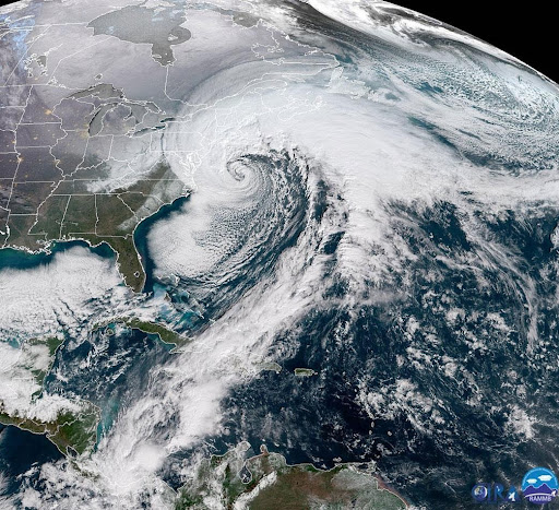 Kiitos. Käytämme tätä aikajanasi parantamiseen. KumoaKumoa
 -
The
#GOESEast satellite is monitoring a storm system this morning that is expected to bring an#EnhancedRisk for severe weather to parts of the southern US.#Lightning flashes can already be spotted moving across the region in this GeoColor loop.pic.twitter.com/eQvVlLe0hqKiitos. Käytämme tätä aikajanasi parantamiseen. KumoaKumoa -
NOAA Satellites uudelleentwiittasi
Last night's
#AuroraBorealis was particularly bright over the Pacific Northwest for the 1am PT#NOAA20 satellite overpass. https://cimss.ssec.wisc.edu/viirs/imagery-viewer/ …#NorthernLights#Aurora#WAwx#ORwx#BCstormpic.twitter.com/PZ8f616TJI
 Kiitos. Käytämme tätä aikajanasi parantamiseen. KumoaKumoa
 -
NOAA Satellites uudelleentwiittasi
VIIRS Day Cloud Phase Distinction RGB observations of snow cover in the northern high plains. Seen by NOAA-20 at 1903Z, 28 Dec 2021.pic.twitter.com/gz6dzbwZr8
Kiitos. Käytämme tätä aikajanasi parantamiseen. KumoaKumoa -
NOAA Satellites uudelleentwiittasi
Anyone seeing the wavy clouds this afternoon? These clouds are often associated with gravity waves (i.e a wave of energy moving through a stable layer of the atmosphere).
@NOAASatellites illustrates this nicely over western NC & southwest VA this afternoon.#wvwx#ncwx#vawxpic.twitter.com/OvsXaCUNshKiitos. Käytämme tätä aikajanasi parantamiseen. KumoaKumoa -
Today,
#GOESEast is looking at the late-December snow cover across the western U.S. in this Day Snow-Fog composite loop. This imagery helps distinguish snow cover (dark red) from water clouds/fog (white/blue), ice clouds (pink) and bare ground (green).pic.twitter.com/QmHkqPxt3IKiitos. Käytämme tätä aikajanasi parantamiseen. KumoaKumoa -
NOAA Satellites uudelleentwiittasi
In December, it is winter in the Northern Hemisphere, but summer in the Southern Hemisphere.
 Why? It is due to Earth's axis tilt!
 Learn more about Earth’s seasons with our resources here >> https://bit.ly/3yEOz6U pic.twitter.com/jqmbT7NsFW
 Kiitos. Käytämme tätä aikajanasi parantamiseen. KumoaKumoa


Lataaminen näyttää kestävän hetken.
Twitter saattaa olla ruuhkautunut tai ongelma on muuten hetkellinen. Yritä uudelleen tai käy Twitterin tilasivulla saadaksesi lisätietoja.